West Coast Trail
Preliminary Notes
Glenn Davies from Calgary
Hiked from June 11, finishing June 19, 2013.
The Parks Canada web site http://www.pc.gc.ca/pn-np/bc/pacificrim/activ/activ6a.aspx has lots of important information and tips for the trail and should be consulted.
I have done extensive camping from a car and a motorcycle. I have done lots of day hiking. This was my first time combining the camping and hiking together in the back country. I was 61 years old at the time of my hike, but I do work out regularly at a fitness center.
The week before my hike was dry and warm. During my hike I only had rain 2 nights and nothing during the day. So this was essentially a dry hike. I can’t compare this to a hike where it rains most days.
Sleeping is something to consider. There is no civilisation noise on the trail. But the noises you will hear may make for poor sleeping conditions. At the campsites you will usually have a choice of sleeping on the beach or in the edge of the woods. Some camping areas are small and the tents will be close together so snoring in adjacent tents may happen. Some campgrounds are near sea lion haul outs and the sea lions love to sing all night long. Most campgrounds are near river mouths with frogs and the frogs start croaking as soon as it gets dark. Poor sleep at night will lead, over time, to exhaustion as the hike progresses.
I packed food for 10 days with the intent to take my time. In my training the 75 km hike would average 7.5 km per day so I trained at 8 or 9 km per practice hike. I was hoping that camping would be possible at places other than the official campsites. There are some unofficial places where you can camp but there are no washrooms or food boxes at those locations. Because I took my time I had the opportunity stop at view points, take lots of pictures, see lots of animals. Most of the hikers were walking the trail to be able to say they hiked the WCT, but they didn’t take the time to enjoy the trail.
Many people over estimated how quickly they could hike the trail. The result was that these hikers had to really rush the last part of the trail. Several groups had bus and plane reservations at the end of the hike and were struggling to make the connections. I met a couple of groups that were actively fighting because of different hiking speeds and connection rushing.
There were lots of mud puddles along the route with some of them well over the ankle deep. Water could frequently be seen seeping out of the ground around the puddles despite the lack of rain. There are 3 ways to handle the mud puddles and all are used by hikers:
1. Walk right through the middle of the puddles without regard to the depth. If the mud is deep then there is a lot of suction pulling the foot out and that will slow you down. There is also the possibility of getting water in your boots.
2. Check the depth of the mud with a walking stick and if shallow, then walk through the mud; otherwise find a way around the mud. Shallow mud is subjective but I set that level at about ankle deep.
3. Find a reasonably dry way around each mud puddle. Dry route could be on sticks and stones either in the middle or the edge of the puddles. Most puddles can be traversed this way. The time to find the dry route makes this method the slowest puddle crossing plan.
Getting around: There are private busses from Victoria that can get you to either trailhead, and between trailheads. Many people flew into the Victoria airport and took local transit to the bus terminal to catch the private bus to the WCT. There is paid parking in Port Renfrew with a pickup service that will get you to/from the Gordon River trailhead. The PC web site says that you can park at the Pachena Bay trailhead but it is not secure; and I did see lots of cars parked there (I believe it is free parking at the trailhead). If parking near a trailhead, then take the bus to the other trailhead and hike back to your car so you don’t have to wait for a bus to get back to your car.
Question: To hike north from Gordon River or hike south from Pachena Bay? Based on what I saw, most people hiked north.
· If you hike north then you start with a river crossing and the hardest part of the trail. Based on bus schedules in operation at the time of my hike you should be starting at the beginning of the day. Your pack is heaviest but it gets lighter when the trail is easier and you can make better time at the end. If you like climbing down tree roots then this is the direction to travel as most of the tree roots are on the wetter north side of the hills. At the end of the trail you can walk out to the parking lot where your car can be waiting. If you start here, then the first campsite is either Thrasher Bay at 6 kms or Camper Creek at 13 kms. If you go to Thrasher Bay, then you are probably committing to walking the beach from Thrasher Bay to Camper Creek with tide levels being important. If you stay at Thrasher Bay and plan to go by trail to Camper Creek, then leaving Thrasher Bay is a hard 1 km climb up a hill. Note the Parks Canada cautions about trying to reach Camper Bay by trail in one day.
· If you hike south then you start with a heavy pack on the easier part of the trail. You will be climbing up tree roots. You will be more tired during the harder part of the trail due the exhaustion of the hike. When you get to the other end, you must reach the Gordon Ferry by 16:30 or you will have to stay on the beach for another night waiting for the ferry to start the next morning. Note the length of the final day hike from either final campsite to figure out the probability of reaching the Gordon ferry on time. The first campsite is Michigan Creek at 12 kms.
Distances are counted from the north trailhead at Pachena Bay. During orientation the Ranger will tell you that the distance halfway point is approximately the Cheewhat River at 37 kms. However the halfway point time wise is at Walbran Creek at 53 kms. This is an indication of the difficulty of the southern end of the trail. The first 4 km out of Gordon River are the hardest on the hike.
When stopping for a rest, I learned it was much better to always stop next to a rock or log and sit down on it with the pack on the seat. Then I could slide out of the straps without having to drop the pack to my feet. When getting back into harness, it was far easier to stand up from the sitting position that it was trying to get the heavy pack off the ground with me in the straps. Pulling the pack up from the ground and dropping it on one shoulder before putting the other arm in the straps can lead to a sore shoulder.
During orientation the Ranger will tell you that entrances from the beach to the trail or ladders or camps are marked by buoys in the trees. While this is true, sometimes the buoys are not very visible and there may be only a couple of buoys. Since there are lots of buoys that get strewn around the beach by the weather, it pays to pay close attention to the map and distance markers when looking for that elusive opening. And there are no distance markers on the beach.
My travelling speed varied from 4 km/hr down to less than one km/hr. It depended on the terrain and the quality of the trail. Keep this in mind when figuring how far you will go in a day.
Gear Discussions
Note the recommended weight maximum for a pack; it is a percentage of your weight. See the Parks Canada information. And note that men and women have a different percentage.
Boots – Around many campfires I saw leather hiking boots steaming away as they were drying. You will need waterproof foot gear. I heard tales of people hiking in open sandals but it would be too easy to get mud and stones under your foot slowing you down as you frequently stopped to clean the sandals. I used a Salomon lightweight fabric above ankle hiking boot. It had a Gortex layer making it waterproof. Stepping through cold water I could feel the temperature change, but water didn’t get in.
Sandals – For river crossings along the beach and for wearing around at camp. I brought good hiking sandals with excellent tread. These had leather uppers. The leather didn’t dry out and my feet would get cold walking around in the evening as the temperature dropped. The good grip is not required when crossing the river outlets on the beach. A good pair of rubber sandals would have been OK and would not have absorbed water.
Socks – I wore double socks. An inner sock that was light and wicked moisture away from my skin. On top of the inner sock I wore a thick sock that could absorb the moisture and provide some insulation from the boot and any cold temperatures that I encountered. The socks should be dried out every night and the method that I used was to put the socks inside my sleeping bag so that body heat would dry them.
Gaiters – While testing my gear near home I initially used my cross country skiing gaiters that have zippers to close them. The zippers clogged with mud and were quickly non-functional. I bought a new set of gaiters that use Velcro to close them and these worked fine in the mud.
Clothing – On the WCT website they recommend against cotton clothing. Cotton doesn’t dry in the humidity on the trail. The only cotton article that I brought was a towel and after a day in the sun it still hadn’t dried. Try bringing hydrophobic clothing materials. Searching the internet will give you the water absorbing or wicking abilities of man-made fabrics. Merino wool sweaters are really comfortable and not itchy – without being too hot or too cold. You will want separate clothes for wearing around camp rather than the clothes you hiked in all day. But keep things light weight. Long pants are recommended on the trail portions of the hike to protect legs. The beach portions could be walked in shorts.
Rain Gear – I brought a heavy weight insulated rain jacket, and didn’t need it. A better idea would have been a light weight rain shell that could have gone over insulating layers. A mistake I made during pre-hike testing was to put on the rain gear before boots and gaiters. With the gaiters on the outside of my rain pants the water ran down my pants and into my boots.
Hat and Sunglasses – Hats are your preference except in rain you want something that will keep water out of your jacket. Much of the hike is on the beach and the sun reflecting off the water can be hard on the eyes. Bring sunglasses.
Hiking Poles – I saw some people without hiking poles. Poles can make it difficult to go up and down roots. For most of the trip I used poles going over roots and it works but it takes time to figure out where to put the poles so you can use them to help climb or descend. You can use hands to just grab at root parts but you will get dirty hands from all the roots. If you are not walking through the center of mud holes, then you will need poles to check for mud depth and to help balance on the bits you use to cross the mud. On the broken parts of the boardwalk poles are essential unless you frequently walk tightropes. Walking the long logs, I found the poles helped to maintain balance and a higher speed while traversing. From extensive hiking experience, I know that poles are a great help when ascending and descending hills. So the choice is yours.
First Aid Kit – Stores that sell hiking equipment should have complete, small, lightweight first aid kits for hikers. The kit that I bought had some moleskin, but I bought several more sheets. Moleskin didn’t stick to my skin and didn’t stay on unless I had lots of overlap – generally twice around a toe. At the first sign of a blister, add moleskin.
Water Treatment – All water along the trail comes from surface sources and should be treated before drinking. I considered bringing a filter but decided I didn’t want the weight and the possible maintenance. Instead I opted for 2 part drops. I didn’t get sick. I carried 2 litre size water bottles for drinking water. When one emptied, I filled it at the next water source and treated it. By the time the other bottle was emptied, the first bottle would be ready for drinking.
Cooking Equipment – I didn’t bring any. Every other group had a small stove and a propane tank. I experimented with dried foods that absorb water. I had a half litre bottle that at breakfast I would fill with supper food and water and let it sit in my pack all day. Lentils, couscous, dried spaghetti sauce and spaghetti did just fine. Quinoa did not work and unfortunately I didn’t test that one before the hike. Oatmeal for breakfast was put in my bottle with water when I went to bed. I admit that I missed a hot meal sometimes when other campers were eating their hot food around the fire place.
Fire – Being an old camper, I brought strike-anywhere matches in a waterproof case. The modern strike-anywhere matches don’t start very well if not using the side of the original box. A much better idea that the young campers use is a butane lighter. The only firewood available is drift wood. As you are not allowed an axe, bring some fire starter. I used small waxed fire starter blocks.
Drugs – I don’t normally take drugs, but my wife advised that I take along some Advil in case I got sore muscles, to prevent stiffness. The Advil was greatly appreciated the first few nights to relax the sore over worked muscles. After 3 nights I was used to the hiking and didn’t need the Advil anymore.
Animals – There are animals in the woods; some you don’t want to run into but they are nice to see. I don’t like bear bells as the constant noise annoys me when hiking. I brought a whistle to blow if I saw a bear.
Preparation
Everyone told me I couldn't do it alone. I visited the WCT web site and there are no rules against it. I expect there to be lots of other people on the trail if there was a problem. Others said that you won't see anyone while walking. That is expected as others will be heading for the next camp site starting at different times at different speeds or going the opposite direction.
Gerry (my sister) told me my planned menus wouldn't work because I wasn't going with expensive dried foods. I intend to use normal dry food I can get at a grocery store. I also will not bring any cooking equipment as I have experimented and discovered that if I leave the dried foods soaking for a couple of hours that they will absorb water while I am walking.
Gerry did warn me that the biggest concern was blister management. That does sound very important and I will look into that.
One thing I noticed in the pictures from the website was that many people were wearing gaiters to keep mud out of boots. The trail is supposed to be very slippery when wet and a joy when dry sunny. June is supposed to be a wet month.
The plan is to start June 11, allowing 10 days to finish. I need to pick my daughter Gwynivere up in Vancouver June 24.
April 22 I filled my pack with 25kg and went for an 8 km walk with stops for rest and gabbing through trails in Fish Creek. Took about 2.5 hour.
April 23 I took my bicycle and measured several trails so that I could combine them to make required distances.
April 25 Melody and I did another 8 km walk down to Lake Sikome and along the golf course.
These two walks tell me that I can do the required distance even taking 3 times as long due to more difficult terrain. However I did also notice that I was very tired after those walks and wondered if I would do OK with multiple days in a row.
May 1, although I sprained my ankle Monday (2 days ago) during the GS motorcycle riding course it is feeling better today. Loading up my pack, I would play it by ear as to how far I would walk. I started off with a limp and sore hips. After 1 km the sore hips were gone and the limp had lessened. At the 5 km mark needing a rest, I lay down on a patch of grass in the warm sun and watched the birds flying high. Did 7 km.
During Toronto visit I did a couple of 12 km walks with my brother Daryll with no pack at his speed (5 kph) with no bad effects, though the ankle is still stiff and swollen. Also during the Ontario visit the ankle got much better.
May 15, Returned from Ontario yesterday and visited the Y this morning. Put the dumbbells in my backpack and completed a 9 km hike. Gwynivere sent me an email first telling me that my calorie requirements would be a lot higher while lugging a backpack. She also recommended I pick up a first aid kit.
May 16, Spent lots of money at MEC picking up another pair of socks, another wool shirt, some dry bags, FA kit, a solar phone charger and a pillow.
May 18, With Krispin, Perla, Melody hiked 10 km around Glenbow Ranch on mostly easy trails. I had my full camera bag with a couple litres of water for weight.
May 21, Started making up my meals. I expected it to be quick. Instead, between figuring out the calories for each meal, putting the food into individual bags, calculating the daily calories of about 3000, it took several hours. Packing up I realized I needed 2 - 10 L dry bags to hold the food. My clothes fit into a 10 L dry bag. For many years I have thought that our sleeping bags were down filled. While unsuccessfully trying to push the sleeping bag into a 15 L dry bag I discovered that the fill was polyester and not down; that is good. I decided to adjust the backpack straps to put most of the weight on my hips.
May 22, I fully filled the backpack and it weighs 28 kg. This is 35% of my weight and slightly over the recommended weight. I had 2.5 kg of water on board so was fully loaded. Then went for a hike of 4 km. Slight bit of rain so the pack cover was installed. The cover doesn't go over the tent at the bottom of my pack but it should keep all the important stuff dry. I tried getting the poncho on as well with a great struggle to fling the back of the poncho over the pack. I was pretty dead by the time I finished but could have kept going if necessary. The pack would not stay square on my back and my left hip would get sore. I took a long sit at the 3 km point to recover and finish.
May 23, Pouring rain all day. Got into all my rain gear and I now know how to get the poncho over the pack - put over the pack first then climb into the straps and stick my head out the head hole.
By the time I reached the 2 km point my left hip was sore and the pack kept going askew to the left. Struggled another couple hundred metres to a point where I wanted to lay down. After 20 minutes I stood up again and felt fully refreshed.
The feeling didn't last long and by the time I was another km along I was in a bad way and at the top of a descent. My hip was aching and I couldn't descend. At this point my resolve to walk the WCT started to flag. I didn't know if it was the extra weight or my physical condition. The big camera could be replaced, but what did those big photographers do with all their stuff? I jacked up the pack tightening the waist belt and it felt good enough for me to climb down the hill.
I started analyzing what was wrong as when I had the dumbbells in the pack the problems were not there. I remembered adjusting the straps and also realized that I needed some of the weight on my shoulders as well as my hips. Stopping every few metres up the cell tower hill I eventually made it to the bench. I shortened the distance between the shoulders and the hip mounts stopping the waist strap from digging into the top of my hips and possibly pinching a nerve. Took another 20 minute break under the poncho eating nuts.
Suited up again with the shoulder straps down tight to take much of the weight and the pack felt much better. I walked another 2 km without getting sore and only a few rest stops. Then did another lay down break for 10 minutes but could have kept going. Walked the rest of the way home completing an 8 km hike.
The leather gloves were soaked through despite recently waxing them. The sleeves of my old Gortex jacket leaked making my sweater wet but I didn't feel it. My feet felt dry but when I took off the boots the socks left damp marks on the floor. The gaiters were a good idea.
May 24. I have picked up some $5 construction waterproof gloves and a $5 set of 3 liners. Got the pack out again for another walk in the rain. Today the wind is blowing strongly from the west blowing the poncho off the pack and around my knees. The weight distribution was great with the changes made yesterday and now I know that I can do this walk. I did 4 km before stopping at the cell tower bench.
Looking at the poncho and the pack I realized that the bottom of the poncho could be attached to the tent that is not under pack cover. I used the Velcro strips but they don't match up for type. By the time I got half way home the Velcro had let go but I knew that was the solution. There is an eyelet at each corner of the poncho so I added a shoelace to the back corners. Checked the pack and the rain cover had done its job.
May 29. Talking to Gerry, her big concern was blisters and preventing them. She says they are the most common reason for hikes to fail. The recommended solution is to have lots of moleskin and apply it at the first sign of a blister. Checking the FA kit there is a small sheet of the stuff precut into 22 patches. I decide to pick up a second sheet.
May 30, I booked my bus ticket from Port Renfrew to Pachena Bay. The return email gave me the pickup location and I went looking for it on Google Maps. The street view shows me the buildings around the location (not many as it is a sparse town). I wasted lots of time trying to find motel listings to match names I could see. Giving up I decided I could wait until arriving in Port Renfrew. Then I started wondering how I would get from Gordon River back to Port Renfrew after the hike as the distance is 5 km. Lots to figure out when I get there.
June 3, Getting really excited about the trip and decide to leave Wednesday. I am only getting 6 hours of sleep before waking, thinking about my hike.
June 4, Recheck all the dry bags and change the organization of the pack. The motorcycle rain suit has been added but it is very heavy, especially the pants. The pants also take a lot of room so tomorrow I am going to check MEC for some light weight pants. I go searching for a waterproof bag for my camera in case I fall in the water. Nothing available so I check whether the camera will fit in a dry bag, and it will fit a 10L bag. The bag top will roll down several times and air can't get out so I figure water can't get in.
Vacation Drive To Start Of West Coast Trail
Only including hike related information.
Up a very steep gravel road was Blue Lake private camp ground and I took a spot beside the small lake. There is a trail going up the backside of the cliff that overlooks the lake. A good practice hike. So I loaded up the pack as if I was out on the trail and headed for the lookout. While getting dressed I found that the gaiter zippers were destroyed by the mud of my last hike, time for new gaiters. It was steady uphill, some steep and some not so. I made many stops wondering what I had got myself into. But resolving to finish I kept going no matter how many stops it required. Finally at the top I dropped my pack and took a rest with some water and bars.
Decided to try not putting the camera in the pack, instead dangling it from the chest strap. That worked out just fine and and now I need a small chest pack for the camera. Unfortunately on the way down the chest strap disconnected and the camera bounced without too much damage. Walking down was easy. Time up 50 minutes, time down 30 minutes.
Found MEC and spent some time trying to figure out a solution to carrying the camera on my chest. One of the store people showed me lots of non-workable options but did mention clipping a bag to my backpack. I got my camera then tried to find a bag that would fit. Nothing was found in the expensive bags but I found a really light towel bag made from scraps with string carry ties that should do just fine.
Figured out how to attach the new camera bag to my backpack. Also noticed that the pack doesn't sit square on my back but couldn't figure out the problems. It is not to far off and I did make some adjustment so it rides better. Now getting really anxious with tomorrow the drive to Port Renfrew.
West Coast Trail Hike
Logistics, the Port Renfrew hotel is a restaurant pub, the Lighthouse Pub is across the road, the WCT parking at $5 per night is in the Lighthouse parking lot but separate operation, West Coast Trail motel is behind Lighthouse Pub at $149 per night, bus picks up at Lighthouse sign, parking attendant picks up from Gorden River trail head. Alternative parking is .8 km past registration office, but only RV accommodation there. There is other accommodation in Port Renfrew but I didn't price it out. Supposedly you can park beside the Parks Canada trailhead building for free but the only accommodation is the native campground nearby.
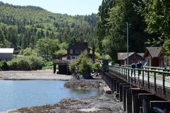
Photo: Port Renfrew hotel
Did a stroll to the end of the wharf by the hotel to see what was there. Just a small mooring area and fish unloading. So headed to the Botanical Beach. Picnic tables available to make my spaghetti dinner with the stewing beef addition - very tasty.
Walked down the trail to Botanical Beach through old growth forests. Folded rocks form this beach with some worn smooth while sharp ridges run across other places. The tidal pools are full of tiny creatures of many types.
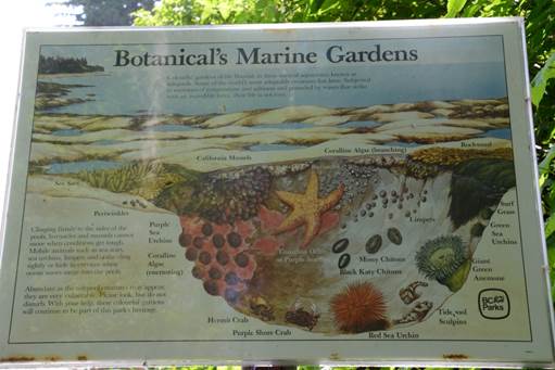
Photo: Botanical Beach creatures
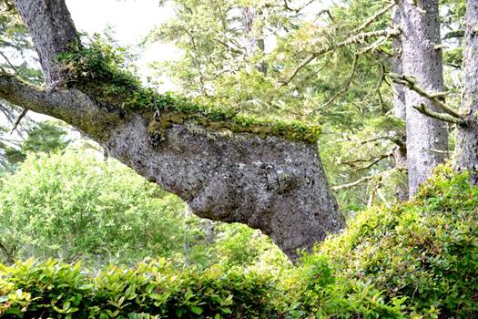
Photo: Weird tree with a new plant layer growing on the tree
Continuing on the trail it heads through the coastal forest to Botany Bay. This trail has been made easy to walk with lots of bridges and boardwalks built by students. I wonder how upgraded the WCT will be since it runs through the same geography. The forest has lots of weird shaped trees and I wonder how they grew like that.
Botany Bay is a small cove that I am surprised they named since the cove just before it doesn't have a name yet is much bigger.
Back at the motel I took it easy and read for a long while until my head started to hurt on top. Worried about a tick there I checked and it turns out to be a pimple - why there? Did a walk around town to wake up and had a couple of sandwiches for supper then decided I wanted a bath to relax.
June 11
Up at 6:30 to get ready. I am now eating my hiking supplies. Officially on the hike - yeah. Excited. The bus to Pachena Bay trailhead is a little late but there are 12 people riding, most starting, some finishing. Finishers tell me they had 7 days of sun. One starter only has 3 days of food and plans to finish.
Orientation at Pachena Bay begins at 1 with no power and a dying laptop. We get through with power at the end. There was rain and sprinkles during the bus ride but it is dry here at Pachena Bay. The forecast is good with a high pressure system coming in. Time to start walking.
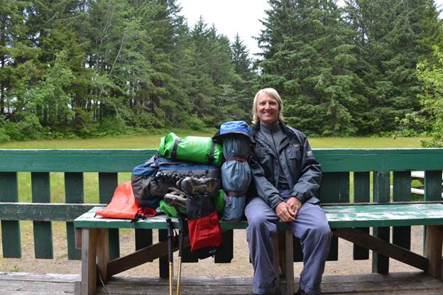 Photo: Me at Pachena Bay ready to start hiking
The first campsite is 12 km so longer than I want. The tide is too high to take the beach route at the start so several ladders up, rough ground over the headland and then several ladders down and I am finished the first 2 km in an hour. At this rate I will get to camp at 8 PM.
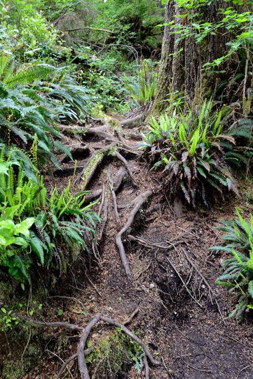
Photo: First encounter with tree roots
After a short while the trail eases up and I can pick up the pace to 4 kph. There are many bridges.
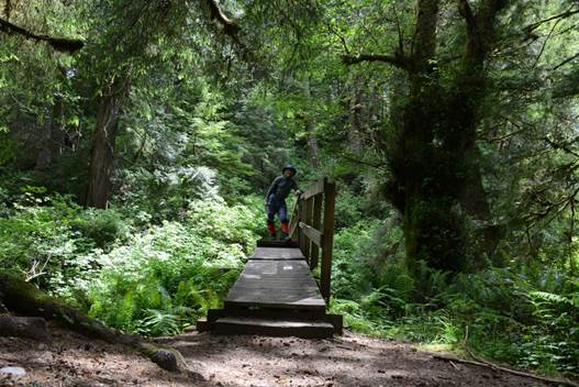 Photo: Bridge #4, me
All bridges have streams rushing below them. I stop for pictures and every 2 km for a snack and water break.
At the 9.5 km point is the side trail to the sea lions. I leave my pack at the top of the long downhill and just take the camera to the viewing point - smart move. Shortly after regaining the main path, the trail crew has set up a 1.2 metre wide tree as a face. At the 10 km point I reach the Pachena lighthouse. Another excuse to drop the pack. The keepers have a great view from here because they can go high but from the ground there are too many trees.
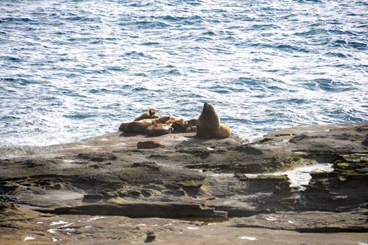
Photo: Sea lions
Photo: Tree cut as face
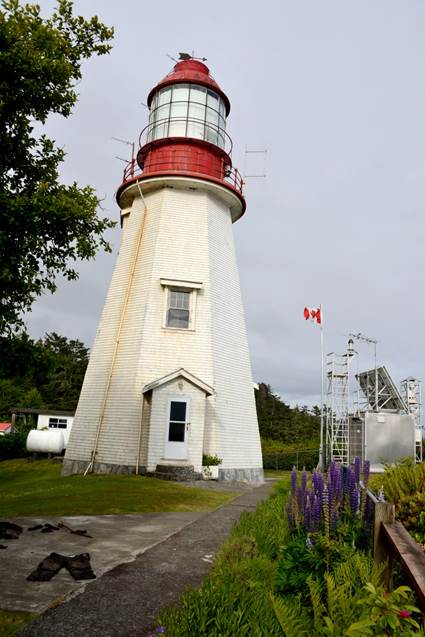
Photo: Pachena lighthouse
Only 2 km to go and I get to camp. It is all up and down hills slogging through mud holes and over roots up big steps and down. This was really hard work to finish the day.
Tents are set up in small openings on the edge of the forest. I pick one just back from the beach. Set up the tent, gather some wood for the fire that some women have made and then sit down for supper. It occasionally spits a bit and the sky is solid cloud but we are hopeful for tomorrow. As my water was undergoing treatment, I took an Advil capsule without water - it didn't want to go down. With the surf crashing I fell asleep about 10:30 as it got dark.
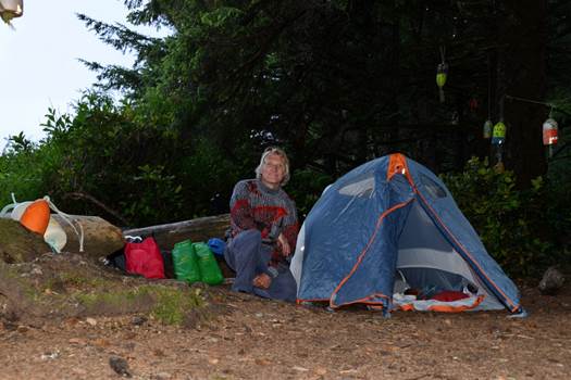
Photo: First night campsite
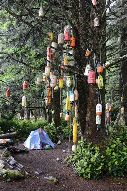
Photo:
Buoys carved by hikers and hung in the trees
June 12
Woke at 4:30 for a bathroom visit. It was spitting. The seaward side of my tent was light so I figured I could see my way through the woods. Totally blind when I got out and headed into the woods for the path to the bathroom. After stumbling around a couple of obstacles I stumbled back to the tent and got my flashlight. With the flashlight I found the path but also noted that in one place half the path was missing – would have be really bad if I had tried this without the light. Back in the tent the spitting changed to rain as I finished out the night.
There are lots of fishing buoys here hanging in the trees with peoples names carved into them, I guess people carry these into the campsite to say they were here. Checking the place where the women had their tent I discovered it is a low spot surrounded by forest and is now a pond. Amazing how much you can do in the small vestibule area of a tent in the rain. I hope the water didn’t get into their tent.
It had stopped raining by the time I left and would occasionally spit. The beach is all giant boulders and difficult to stumble across. I avoided most of it my pushing through the trees and over some logs to get along to a point where I could head out to the smooth rock below the tide line. The tide is out now.
Soon came to the boiler from the Mascotte at the edge of the water. Took a couple of pictures and looked way back to the beach spotting something black and moving. Zooming right in I could see it was a small black bear. A couple more pictures of the bear and I pulled out my whistle. It took 2 whistle blows before the bear headed into the woods.
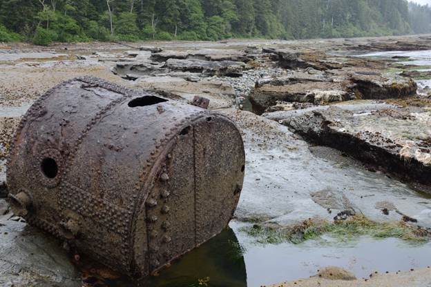 Photo: Mascotte boiler. Note the small black blob
back on the beach near the trees
Photo: Mascotte boiler. Note the small black blob
back on the beach near the trees
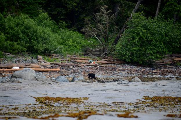 Photo: Black bear visitor. Even he didn’t like
the rocks and walked along the logs whenever he could
Photo: Black bear visitor. Even he didn’t like
the rocks and walked along the logs whenever he could
At the Darling River it was time to take the boots off, put on the sandals, and walk through the very cold water. The beach here is good for walking and I was soon following 4 sets of human footprints from this morning and one set of wolf prints made later. The wolf tracks stay a metre away from the human tracks and followed along the beach until the next stream. I also scared 2 golden eagles from a tree on the beach.
Made it to Tsocowis Creek campground and set the tent up on a rise of sand among a bunch of logs that looks to be well above high tide. Earlier I picked up a float and after lunch I carved "Melody Glenn 2013". Saw an otter run down the beach into the ocean. There are many lost buoys along the beach that can be picked up and carved.
Several times today, and once yesterday I developed great pain in my lower right abdominal area. Each time I was doing something with those muscles, though mostly not much. I wonder if it is a hernia?
Walking down the beach past camp is the pretty Tsocowis Falls with the trail bridge above it. Looks like most people that camp here setup near the falls. Lots of people come off the trail at the food box but that means climbing over lots of logs to reach the sand.
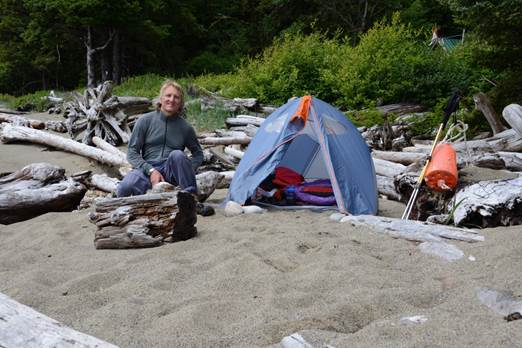
Photo: Camp at Tsocowis Creek
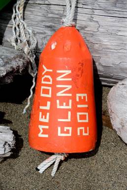
Photo: My carved buoy. Melody was there in spirit as I had a satellite phone to call her each night
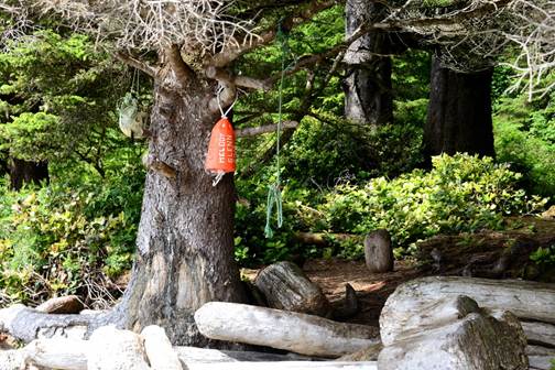
Photo: Buoy in a tree
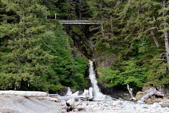
Photo: Tsocowis Falls
June 13
A cold night last night and I am glad I had my warm sleeping bag even though it takes up lots of room in the pack. Overnight it was a mix of stars and cloud. This morning woke early after 10 hours of sleep to a mostly clear sky. As the sun came around and the tide dropped quickly I was able to walk out on the rocks looking in tidal pools while a bald eagle swooped the beach looking for something to eat.
This part of the hike is in the woods but not overly difficult. Lots of mud puddles that take time to figure out the way around so I don't sink in too far. My philosophy is to stay as shallow as possible so I'm not using the energy to suck my boot out of deep mud. Some people walk through the middle of the mud holes and don't worry about the depth.
Stopped at the Valencia lookout for a break. The stomach muscles are still twinging a bit but not like yesterday. Maybe it was just a twisted bowel.
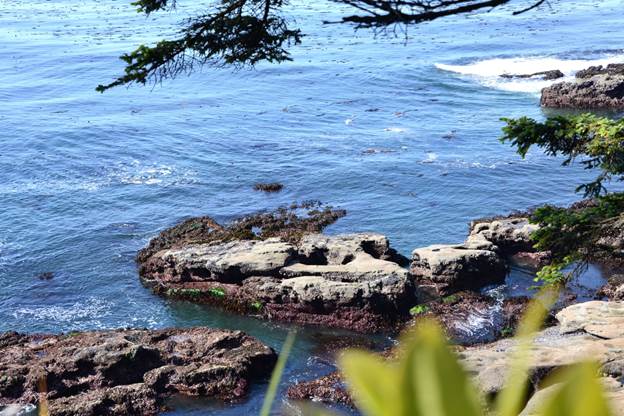 Photo: Valencia lookout
Saw the plow and I have no idea why that was brought here. It is designed for ploughing fields and would not go through the root infested forest. Also saw the rusted out donkey steam engine and not sure what that was used for as it would have been tough to haul through the woods.
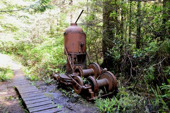
Photo: Donkey engine
Stopped for lunch at the beach access just after km 20. The weather is now hot and sunny.
Walking along the beach means trying to pick your way along the flat tidal rock only retreating to the sand when you run out of rock. Of course this only works at low tide.
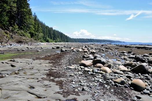
Photo: Beach at low tide. Note the flat rock and small puddles for easy walking
Got to the cable car at Klanawa River and struggled to get the pack into the car with one hand while holding the car with the other. Some of the time I had to use one foot to hold the car because the pack was too heavy to manipulate into the bottom of the car with one hand. Then I had to get into the car myself without letting it start to slide or I would have gotten hurt going past the railings. After loading, the car then rides down the cable to the low point requiring much pulling to raise the car up the cable to the far platform.
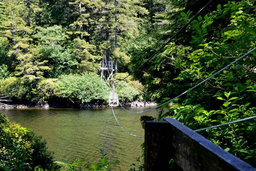
Photo: cable car at Klanawa River
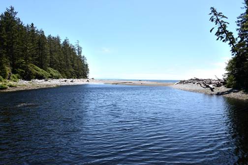
Photo: Klanawa River flowing into the ocean
Getting out was even harder as the pack was caught on the seats and I was still trying to hold the heavy car with one toe. Realized after the fact that what I should have done was use my rope tied with a bow to hold the car in place while loading/unloading.
From the car to the campsite ladders (lots of them) the trail is falling apart board walk. Despite the condition most people walk down the center of the ties. I chose to walk above the rails to avoid the chance of breaking through rotten cross pieces. Many chunks are missing leaving mud bogs to walk through.
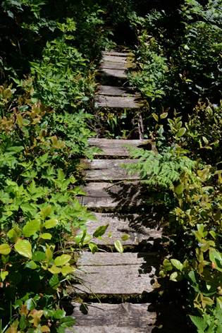
Photo: Falling apart board walk. This is typical of much of the board walk. Some was new. Some was worse than this. I wrote to Parks Canada and they said they are trying to get more money to fix the board walk.
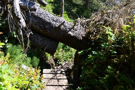
Photo: Trees fall across the board walk all the time. At each fall the trail maintenance people decide what if anything they will do about it. Here they made a crawl path.
At km 24 there is a very nice park bench at the top of the cliff where I sat in the sun to admire the view while a bald eagle flew by.
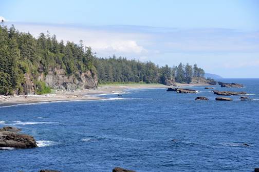
Photo: View from the park bench
The Tsusiat Falls look like an infinite pool from the trail bridge as the water drops off to the ocean. Very pretty from both sides. About the time I got here the weather changed blowing in cloud and cooling it down.
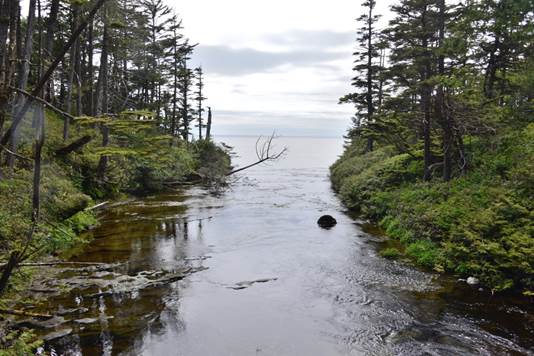
Photo: Tsusiat River flowing to the falls. The last ripple you see in the river is the edge of the falls.
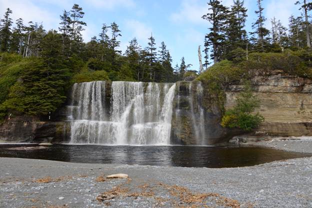 Photo: Tsusiat Falls. Note the person standing to
the right of the bottom of the falls. I took a bath here and discovered the
water is freezing cold
Photo: Tsusiat Falls. Note the person standing to
the right of the bottom of the falls. I took a bath here and discovered the
water is freezing cold
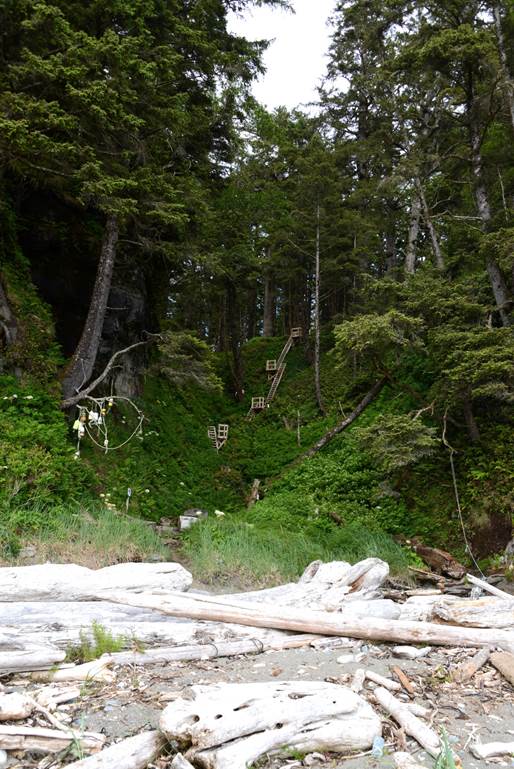
Photo: Ladders coming down from the trail to Tsusiat Falls
I camped on the beach where the ladders deposited me. Set up camp and later discovered that the food box and washrooms are across a log on the other side of the Tsusiat River. Not a long walk so not moving my tent. The log crosses the outlet of the falls running to the ocean and is the only way to get to the camping area by the food box; so you have to walk the length of the log. The area where I am camped looks like it is subject to flooding during times of high waves as it is full of logs that have washed up on the shore. The washrooms are on the only permanently dry high ground at this beach, they are just hard to get to.
The quinoa didn't soften up as expected and I was eating it hard. This is the only dried food that hasn’t done the expected, and the only one I didn’t try at home making the assumption that it would behave like the rest. Quinoa requires the hot water to force it to absorb water. Somehow some of it got stuck in my throat and it took a lot of work to clear. Didn't finish that part of supper.
While watching the rocks offshore a sea otter appeared on one of them. It was maximum telephoto and he wouldn't pose so the pictures are blurry.
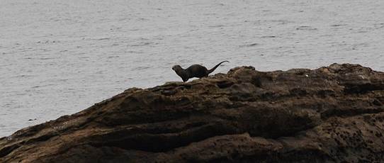
Photo: Sea otter. Shot in low light with a 300 mm lens. Took lots of pictures whenever he showed up at the top of the rock
June 14
Getting an earlier start at 8 because I may have a long way to hike today.
The beach walking is easy and about km 27 I see an eagle sitting on a rock just offshore surveying his surroundings. Have to leave the beach just before IR 2 as there are some headlands in the way. The special camp run by the natives looks nice if you have a group. There are canvas tents with real beds but bring your own food.
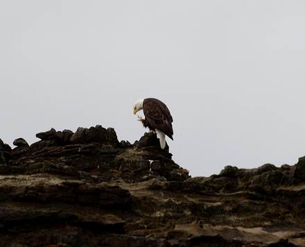
Photo: Eagle on a rock
At the Tsuquadra creek there has been a battle. A winter storm surge blasted many large logs up the river and out on the trail. Then a big blast of water came down the creek and moved all logs from the creek bed downstream 10 metres past the trail and into a big pile.
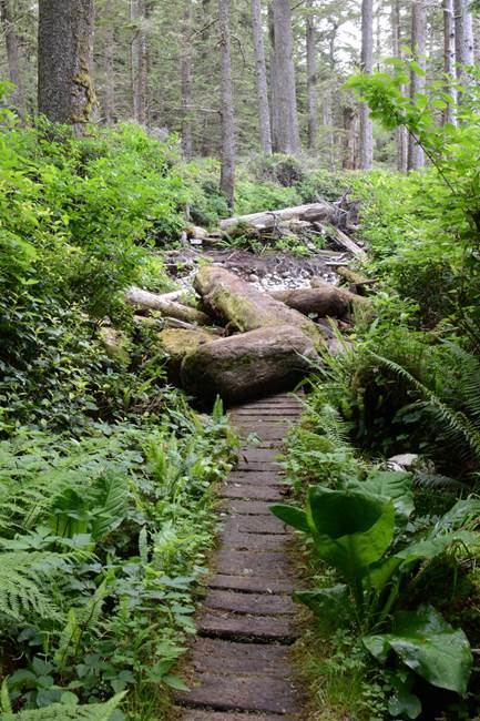
Photo: Trail leading to Tsuquadra creek showing the logs washed up on the trail
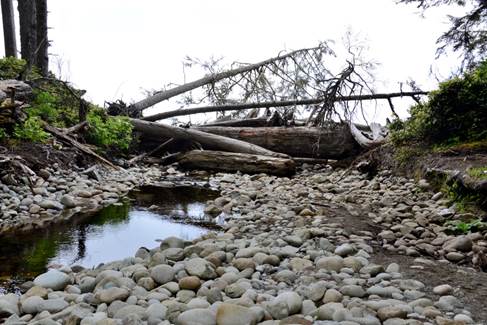
Photo: The logs washed back down the creek
Then back to the trail for the tramp to Nitinat Narrows. There are many lookout points along the usual quality of trail. I came across two 32 km signs so quite a disappointment since they are about 20 minutes apart. The first sign raised my spirits that I was almost at the narrows. The second sign said you haven’t gone anywhere the last 20 minutes.
At Nitinat Narrows I reached the little tippy dock and seeing no one, nor a dock on the other side I announced my presence in a very loud voice. It echoes really well there and a moment later I heard a motor start. Soon a boat came around the corner loaded with a group of 11 travelers who were about to take a little tour out to the ocean and up to Nitinat Lake. Fortunately I had caught them at just the right time and they took me across immediately.
As there was real food available I rested and wrote this log until a cook showed up. Choices are salmon or crab and I opted for salmon as more filling and nutritious and I wouldn't have to try to eat quinoa again tonight. The cook presented me with this huge chunk of salmon very nicely grilled and a large baked potato with lots of butter and chopped green onions. It was delicious and the price was $25 cash only but worth it. The natives locally catch the salmon.
Photo: Restaurant at Nitinat Narrows
A couple other groups showed up while I was waiting, one ending their hike at the narrows. The natives that run the crossing say that it is busy for the whole hiking season. Off season they do some halibut fishing and boat repairs, but really not a lot.
The trail out from the narrows is good boardwalk until the little lake on the map, then back to the usual. The trail came out to the ocean bluffs and the map shows that as after the 34 km point. I was excited until half hour later I came to the sign for that distance. So I don't know which is correct. At this point I realized to take the distance signs with a grain of salt.
In the Clo-oose village I only saw one house along the trail though the map shows many. Despite the map saying there is little to no water available between 30 and 39 kms, on the north side of the Cheewhat River bridge is a small sign saying “water” pointing at a stream coming down the hill. If you don’t mind cloudy water and you have water treatment stuff, there is water under much of the boardwalk.
Back on the beach at 36 km and the walking is easy until the rocky point that goes around to the surge channel at 38 km. I missed the exit point to a ladder up the cliff but as I got closer to the channel I figured I could get around it. Putting all the electronics into their waterproof bags I leapt from rock to rock while the waves subsided. The tide was rising quickly and 15 minutes later I would not have been able to do it. After getting around the channel I now had a cliff twice my height to ascend. Someone had put ropes down to do a descent but I wasn't going to try the climb with my pack. Nor could I have climbed and hauled the pack up as it would have destroyed the pack in the sharp rocks. Looking further out the channel I could see that the cliff got shorter with a place where I could scramble up. All I needed to do was work my way along a section sloped at 70 degrees with a small curl at the bottom. Fortunately the rock was rough and dry giving good traction and I was up on the flats and around the channel. This is not the recommended route.
Photo: The end of the surge channel. The gray sloping rock behind the foreground is the section I had to work along and climb up
The beach access is a long ladder and the map said beach walking is possible below 2m but the tide tables said the tide was higher than that now. I climbed the ladder to the trail. Went back on the beach after Dare point not sure if the map is accurate about tide heights. By this point I was determined I was going to make it. At Dare creek the beach is beautiful and a woman was camped there, but I decided to push on to the official campground at Cribs Creek.
Three other groups also stayed here and we had a nice evening sitting around the campfire. One group was 2 women that had 1.5 days to reach Pachena Bay to catch a bus – good luck. One of the women spent her weekends cycling while the other was a desk jockey. These women had a big fight at lunch today and walked separately to the camp. The women did leave together the next morning. One group had 5 young guys traveling together with lots of food but sharing one tent and lots of complaints of snoring.
The morning had been a mix of sun and cloud, but the afternoon had been hot sun. I had used a cotton towel at the previous camp to dry off after a bath. It sat in the sun for several hours here without really drying out so cotton is a bad idea. Some frogs spent the night croaking to see if they could be louder than the surf.
Photo: Camp at Cribs Creek
June 15
Woke early to a slight haze in the sky and lots of sea lion bellowing. The sea lions have a haul out rock not far from shore. I sat on the rocks at the edge of the water eating breakfast while watching the crashing waves and the sea lions fishing and leaping out of the water.

Photo: Me walking along the hard sand beach
Photo: Sea lions on rock near Carmanah Point
Took my time and left camp about 9. It was an easy walk on hard beach sand so made good time to Carmanah Point. A short way offshore from the big rocks was a small island with more sea lions and much closer if I walked out on the rocks than previously taken photos. While taking shots I looked up at the Carmanah Lighthouse and saw ladders coming down the front of the point and guessed they were the trail ladders shown on the map. Finished with the lions I reached Carmanah Point and was focused on a route through the house sized boulders. Picking my way around the point and not yet smart enough to realize that they would not have made this part of the beach trail I came to 2 metal rungs. Climbing these I could see a chain ladder but it had been pulled up. I could have rock climbed the 2 metres to the ladder but the camera bag on my chest got in the way and common sense was starting to flood into my brain. Not wanting to turn back yet I continued through a small gap in the rocks rather than risk the slippery rocks of the open sea and saw a rotten old tree that would have allowed me to get to a slope that I might have been able to climb. Decided to check further along as it looked as if there might be a rock surface to ascend. There was but it had a big step and I had no technical equipment.
Finally I fully admitted that the trail couldn't possibly go this way. I was already around the point and there was a good walking beach ahead that I could see but the map says there is an impassable headland around the corner. So I turned back the way I had come. As soon as I got back around the point again there was the trail ladder plainly visible from the beach. I had passed within 10 metres of it but because I was focused on the big rocks I didn't see it. Sherlock Holmes I am not.
Up the ladders to the lighthouse I took a picture of a circular garden with the lighthouse behind. Talking to Gerry, the lighthouse keeper, he told me that there is a set of stairs used by the keepers up the hill from the beach I had turned back from, that the impassable headland was very passable by walking up into the woods and taking the last ladder down on the trail to the next beach, and that the round garden was a meditation garden. Starting from the entrance there is only one path and it leads to the center but it is not linear, instead always changing direction to teach you not to be single focused - something I could have used a couple of hours earlier.
Photo: Carmanah lighthouse with the circular garden in the foreground
Saw a woman hiker walking through the lighthouse grounds wearing a bathing suit and low topped hiking shoes. I wouldn't be traveling that way but I guess that she knew that there were several hours of beach walking on either side of the lighthouse and the sun was warm today.
I descended from the lighthouse to Chez Monique where as promised she makes gourmet burgers. Of course I had to have one with all the extras. The plain burger is $18, but the extras add another $7. Monique also has warm beer, but I stuck to Gatorade. Several students were there as volunteers. For room and board they work about 4 hours a day doing what needs doing. I think a lot of it is just company for Monique. Students were from Montreal, Germany, Switzerland. Monique is from Montreal and now married to a native man hence why her place is on one of the reserves. Monique also told me that a full low tide it is possible to walk around the impassable headland at the lighthouse.
Photo: A couple of flower pots just south of Chez Monique
After a full feed, continued on to Bonilla Point where I camped for the night by myself. Feeling very lethargic probably from only 6 hours sleep last night. After more food and making a fire I am feeling better but will get to bed early tonight as the hard part of the trail starts tomorrow.
Photo: Camp at Bonilla Point
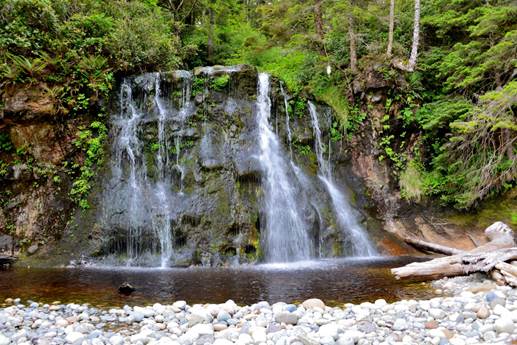
Photo: Bonilla creek coming out to the beach
June 16
Woke to a heavy cloudy sky with fog out over the water. A hot breakfast would have been nice this morning to warm the mood. Feeling a little down today.
A couple of storks sitting on the rocks at maximum range. Up early today with 9 hours sleep. I had set the tent up with a slight downhill slope to the head. When I awoke after 4 hours I was aware that this was wrong and had to switch ends, my head now in the small end of the tent.
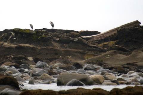
Photo: Storks on a rock
Developed a small blister yesterday so taped it this morning along with the toe beside that looked like it was thinking of starting a blister.
The beach walk to Walbran Creek was fairly easy with about a third on low tide rock. Saw several people that wouldn't walk the rock instead choosing to walk the soft fine gravel that they sink into. Noticed lots of big fishing trawlers heading out to sea. First time I have seen so many so perhaps they go out for the week.
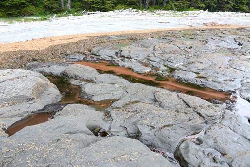
Photo: Water with red specs in it. This line of water was full of red bits and I didn’t know if this was an example of red tide. This is the only example I saw on the whole hike.
At Walbran I should have looked at the map, put on my water shoes and walked across the mouth of the river. I still had to put on my water shoes for 2 river crossings to reach the cable car via a now non-maintained path that I fought through. Again when the path becomes too difficult, I should realize I am going the wrong way. Part of the route I took was through a large pile of sharp rock from a recent rock slide. Gotta learn that lesson, but I keep on saying to myself “that since the trail is poorly maintained these obstacles are just part of it”.
Having lunch and washing the mud off. I have 4 km to the campsite at Culite. The first km takes an hour. This part of the trail requires that you be very comfortable walking along logs up to 40 metres in length. There were also several places where the boardwalk was collapsing and only a single rail was left with 30 - 45 cm depth of water if you stepped off. Some people had started making wide detours through the brush to get around the rails and water as this area was more meadows than woods.
While walking along I was thinking about how useful the poles are for testing mud depth, stepping up and down roots, maintaining balance on logs when along came a couple without poles. Without the poles I would be a lot slower as I would constantly be checking my balance before making the next step.
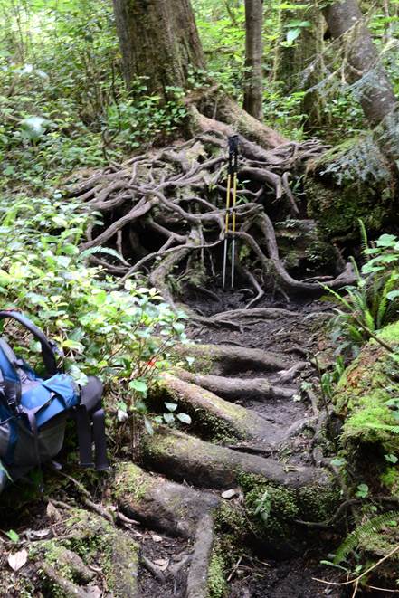
Photo: An example of a root to climb over. Some are easier and some are higher. The walking poles are 145 cm tall
I keep hearing a bird whose song starts with 2 bear bell tones before finishing the rest of the song. At first I thought this was other people on the trail, but when they never turned up, I started figuring it out. On the northern part of the trail there were lots of humming birds at the campsites. On this southern part of the trail I am not seeing any humming birds.
Got to Logan Creek in better time but still not fast. Crossing the creek requires lots of ladders down, then a big suspension bridge with a great view, then lots of ladders up. On the up side there was a seat in the sun half way up that I took advantage of to rest and have some food before the final 2 km.
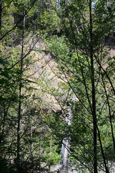
Photo: Logan Creek bridge
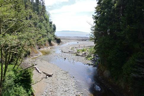
Photo: Logan Creek flowing into the ocean
This time when I reached Culite Creek I remembered that others had told me they didn't use the cable car so I left my pack at the station, went down the ladder, checked if there was a route to the campsite from this side. All that was required was the confidence to do easy stepping stones across a shallow river. It saved me a pointless cable car crossing.
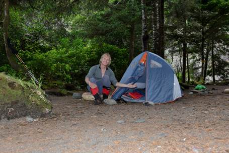
Photo: Camp at Culite Creek
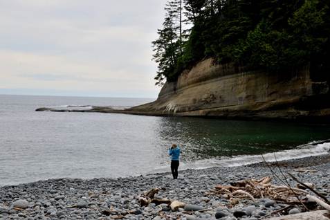
Photo: The bay at the exit from Culite Creek and the Belgium woman
The weather is spitting but the feeling of rain has passed. I have company tonight. The couple is from Belgium. She had a business trip to Vancouver and brought her boyfriend along so they could take a couple weeks of holidays afterwards. Belgium is not a big place but when I started describing the parts that I visited last September, mostly French parts, they didn't know anything about the areas. They are from the Flemish part of Belgium.
To wash I had walked into the river and gotten my sandals wet. Had a nice fire but should have put my feet up to dry my sandals. By the end of the evening with my feet in wet sandals they were cold. For the first time this trip I used the sleeping socks I brought along.
June 17
Day started with a mix of sun and cloud, but due to the tall cliffs on both sides of our little bay the sun will not be visiting until much later. Saw a martin, I think, as it was smaller than an otter with furry tail, run by while eating breakfast.
Today the plan is to hike to Camper Bay, 4 km. But I may decide to do the extra 3 km to the beach access at A on the map. That would set me up for the beach walk to Thrasher Cove.
It has been hard slogging today with endless mud bogs and roots. Very little boardwalk and most of it in poor shape. With not much to do while walking I started analyzing the techniques used to cross the bogs. Those that avoid the deep mud have to slow or stop at each hole to pick the driest way through and also depend on their poles to help balance while walking over roots and rocks. Those that walk through the middle just plow on through only slowed by the sucking of the boot out of sometimes deep holes. I don't have any idea if the boot extraction slows them as much as planning the drier way through.
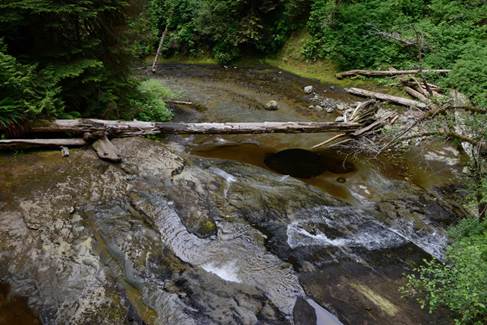
Photo: Sandstone Creek. The black area was a deep round hole that had somehow been carved in the rock.
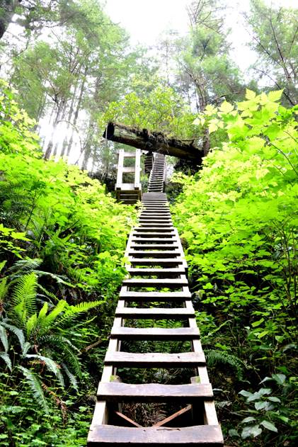
Photo: A log that has fallen and is hanging over the ladders. Wonder how long until the log crashes down on the ladders
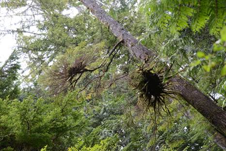
Photo: New trees that have started sprouting in the high humidity on the existing branches of a tree
As the trail is very repetitive and I get bored easily I started doing trail maintenance. So far I filled in a mud bog with logs, and drained 2 others that had debris dams at their outlets.
Stopped at about 13:00 for lunch at about km 61, after doing about 3 km in 3.5 hours. This is the high point on the trail. The builders have the philosophy of why go around something when you can go over it.
Very pleasant surprise as just a bit down the hill was the 62 km sign and I had gone one extra than I thought. Campers Bay was shortly after that where I took another break and had some more lunch.
Skipping the cable car I did stepping stones over the river and was soon ascending the many ladders. 3 km to Beach Access A, and it took me 1.5 hours. I changed my mud philosophy to not worrying about it if the existing footprints didn't have any water in them so there is no suction coming out.
Met many groups heading to Campers Bay. It will be crowded there tonight. They are on day 2 and the weather forecast they were given is for rain Tuesday or Wednesday.
At Beach Access A there is a clearing in the woods that would have made a nice camping spot. No fires are allowed in the woods and there are no bathrooms. Out on the rock beach was a small space I could have used for my camp but decided to explore and discovered that Beach Access B has a much bigger rock surface. So I brought the gear along the beach and set up in high winds. Going to be an interesting night with a fairly big slope to my bed, the wind howling, and it is pouring rain over on the San Jaun islands. Hope the rain stays over there.
The rain didn't stay where it belonged and started falling just as I sat down to eat. Everything got quickly moved into the vestibule and I ate in the tent. Against the rules, but what bear in his right mind is going to come down a cliff to wind swept bare rock looking for food. Fortunately I had called Melody on the sat phone just before the rain.
The rain lasted for an hour, stopped, and the clouds started breaking up. An eagle was sitting on a rock just offshore. They really like the coast here. Wandered around my rock shelf and discovered there is lots of life trapped in the little pools cut in the rivulets in the rock. Many have tadpoles. Some have other tiny wiggling creatures. Their early life is trapped in these tiny bowls hoping it rains often enough to keep the liquid up, and they are fresh water as the tide would never come this high. Sitting watching the sea, all this would have been missed if I had stayed in the woods.
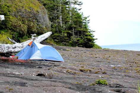
Photo: Camp at Beach Access B
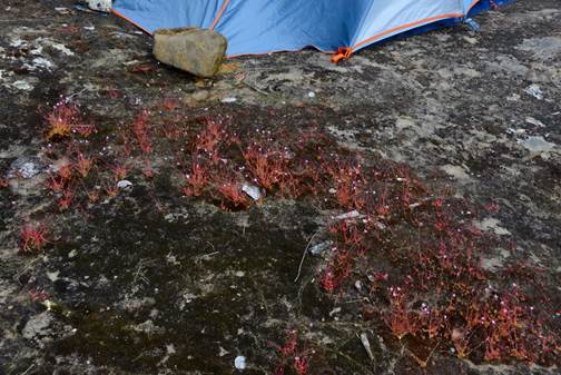
Photo: Flower garden beside my tent with tiny pink flowers
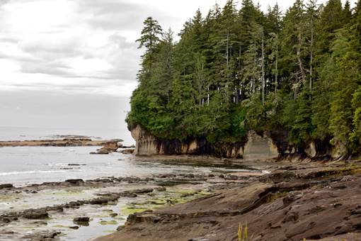
Photo: The point in the picture is the path from Beach Access A to Access B. I hiked it at low tide and now it is under water
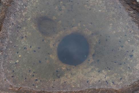
Photo: One of the holes in the rock near my tent full of tadpoles
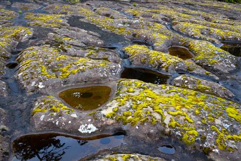
Photo: Good view of the rock surface near my tent
I got a couple of hours of reading and writing before I turned in at 8:30. It rained on and off through the night. Checked outside around 2 AM with the sky semi clear.
June 18
There hasn't been a single night yet where the sky has been completely clear at night so I could see the stars in all their glory without the air glow usually found in Calgary. And that despite 7 days with no rain. Because of all the tadpoles, I was serenaded by frogs all night.
Raining this morning so will be eating, dressing, and packing in the tent. By the time I finished packing the sky had broken up to another beautiful day so the rain gear was put away.
Left Point B at 7:55, an hour before a 2.5 m high tide. This beach walking is unlike any done so far this trip. There are many surge channels (splits in the rock from sea to forest) that have to be traversed or walked around. 2 channels require a trip through the woods and holding onto the supplied rope to avoid sliding down slippery rocks into the water.
The rock is like walking on Mars. There are nodules sticking up, many craters, rocks embedded within the rock. Some wet and slippery, some dry. I reached Owen Point just as high tide arrived at 8:55. A large group of seals came near shore to greet me and investigate what I was.
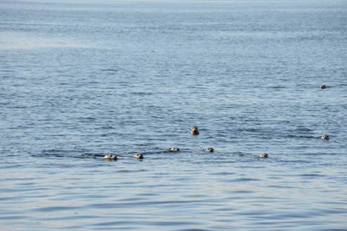
Photo: Seal visitors
I had a snack and got ready to leave at 9:30 only to discover that 20 m further on was a rock bay full of water. My tide was 2.5 and the map says it can be traversed at 1.8 so options are to wait or to go around. Didn't take me long to find the route made by some industrious trail users. On the near side there was a single rope going up a 2 m mud slope, followed by the usual trail terrain, leading to a 2 rope climb down a 2 m rock wall. It got me around the bay without having to wait 3 hours.
Then it was on to boulder beach down to Thrasher Cove. Started out as simple stepping stones for quite a way lulling me into thinking it would be this way all the way. But this is WCT. About a third of the way to the Cove it became house size rocks to navigate around for several hundred meters. Then it switched to mostly car size rocks for most of the rest of the way. Not overly difficult just time consuming as I was constantly pausing to plan the next part of the route. Remember: barnacles are your friend, seaweed and wet rocks are slippery. I was using my hands a lot to hold on instead of balancing with the poles. Took 2.5 hours to get there.
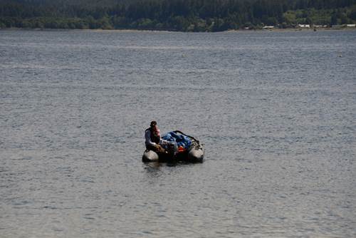
Photo: Natives maintain the campsites along the trail. They use boats to reach these sites
Was planning for a longer lunch but a storm was coming from San Jaun islands and I was running short on time to reach Gordon Crossing. In retrospect I should have camped at Thrasher Cove and finished the trail the next day. Meeting people going the other way they told me that it was forecast to rain tomorrow and the storm from San Juan looked the same today as it did yesterday afternoon. I let myself be scared by the possibility of rain. And it didn’t rain the next day despite the forecast.
I headed up the ladders for the 1 km connection to the main trail. What a hill. It started with ladders, but most of the way was steep uphill until very near the connector. Lots of breaks were required. Again took longer than expected. Stopping for a snack at the junction I encountered my first mosquitoes of the trip. However only 5 km to go and 4 hours left.
From the junction the trail was actually pretty good. The usual procedure of up instead of around but soon reached some fairly open woods with decent trail where I could make some time. Near the end of this section, I came to the other donkey engine. While walking to the engine I had seen lots of 5 cm thick steel cable running through the woods and wondered what it was for. At the donkey engine, I figure it out. The lumberjacks would go in and fell a tree. The cable would be attached to the log and the engine would pull the log out to the engine. Then horses would drag the cable back to the cutting point. I don’t know how the logs would be gotten out of the woods. This engine is in much better shape than the engine at the other end of the trail.
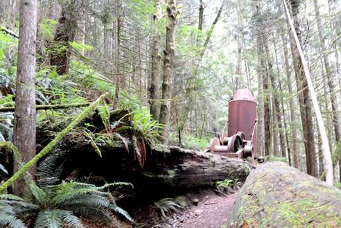
Photo: Donkey engine
Then at the 72 km point the trail went to hell. I was hoping for a nice walk out instead getting 3 of the worst km I have seen. Up and down, lots of big roots. Very little good trail to relax on and make up time. I saw a Chinese father I thought by himself and then a couple minutes later I saw the teenage son who didn't look happy to be here, and they were only about 1.5 km in at 16:00, going to be a long grueling trip for those 2.
The trail didn't let up right to the end. I guess they don't want to give a false sense that the trail was easy to the people starting at Gordon River. I reached the end of the WCT at 17:00, while the ferry man goes home for dinner at 16:30. One more night camping on the shore waiting for the first ferry in the morning. Gave me an opportunity to take pictures, dry out the wet tent from this morning, and stuff the trail clothes into a bag as I will not need them again this trip. Had lots to eat but not the usual food soaked for a day. I will have company tonight as I hear some people arriving at 20:00. A group of 6 walked out of the trail and set up around the landing point. There were 3 guys from the military and the fathers of 2 of them and as well as the brother of one of the fathers. While talking to the newcomers, I noticed that the rock I had sat on to eat supper was now mostly under water with the waves lapping close, but not too close, to my tent. I hadn’t expected the tide to come up the shore that much.
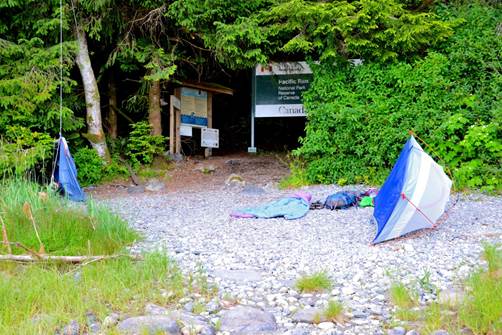
Photo: Camp at Gordon River crossing
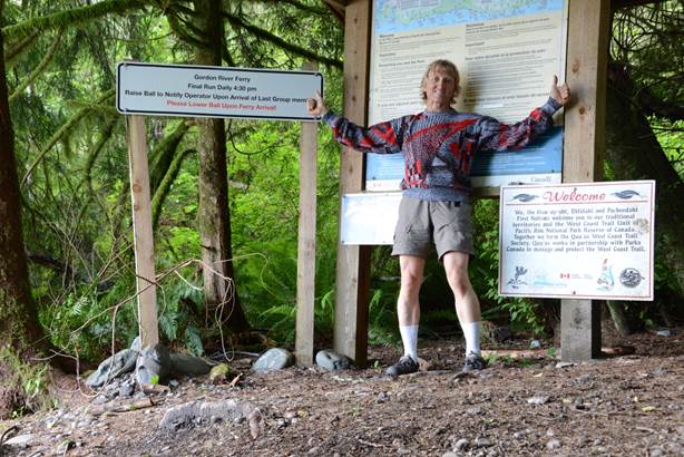
Photo: Finished
June 19
We were all up early when the sun came up. A light breakfast was done with lots of time to dry out dew dampened tents. Had lots of time after packing to joke around while waiting for the ferry to start at 9:00. The ferryman dropped us off at the WCT office where the Ranger was just opening up. The Ranger called the pickup for the parking lot and then casually asked if we had seen any land animals. I was the only person that had and was suddenly filling in forms about the bear and wolf tracks that I had seen.
The pickup truck waited for me and I was back to my car. A shower would have to wait, but I went to the café and had a big breakfast of real food.
That was the end of my WCT hike. It was exhilarating, challenging, fun, frustrating, learning experience. My immediate thought was that I had done it with no need to do the WCT again. However, later thought has said I could do it again with the right people. I don’t think I would solo it again as there is not enough new to see to warrant the effort. A group walk would provide the opportunity to discuss the things seen on the trail as it was walked. I definitely feel the solo walk was worthwhile to prove to myself that I could do the hike, and to see the trail exactly the way I wanted to without group concerns. The many people that I met were mostly just walking in order to say they completed the WCT. My feeling is that attitude wastes much of the walk. For that much effort, take the time to look around and enjoy the scenery, the animals, the trees, difficulties of the trail.